


rajas mailhebiau

Alain28/01
User
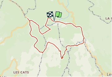

Length
19.7 km

Max alt
1467 m

Uphill gradient
466 m
Km-Effort
26 km

Min alt
1252 m

Downhill gradient
471 m
Boucle
Yes
Creation date :
2023-12-05 16:39:39.136
Updated on :
2023-12-05 16:41:33.017
5h53
Difficulty : Difficult

FREE GPS app for hiking
 SityTrail
IGN / Geographical institutes
SityTrail Plus
The world is yours!
About
Trail Walking of 19.7 km to be discovered at Occitania, Lozère, Les Salces. This trail is proposed by Alain28/01.
Positioning
Country:
France
Region :
Occitania
Department/Province :
Lozère
Municipality :
Les Salces
Location:
Unknown
Start:(Dec)
Start:(UTM)
507407 ; 4935850 (31T) N.
Comments